| |
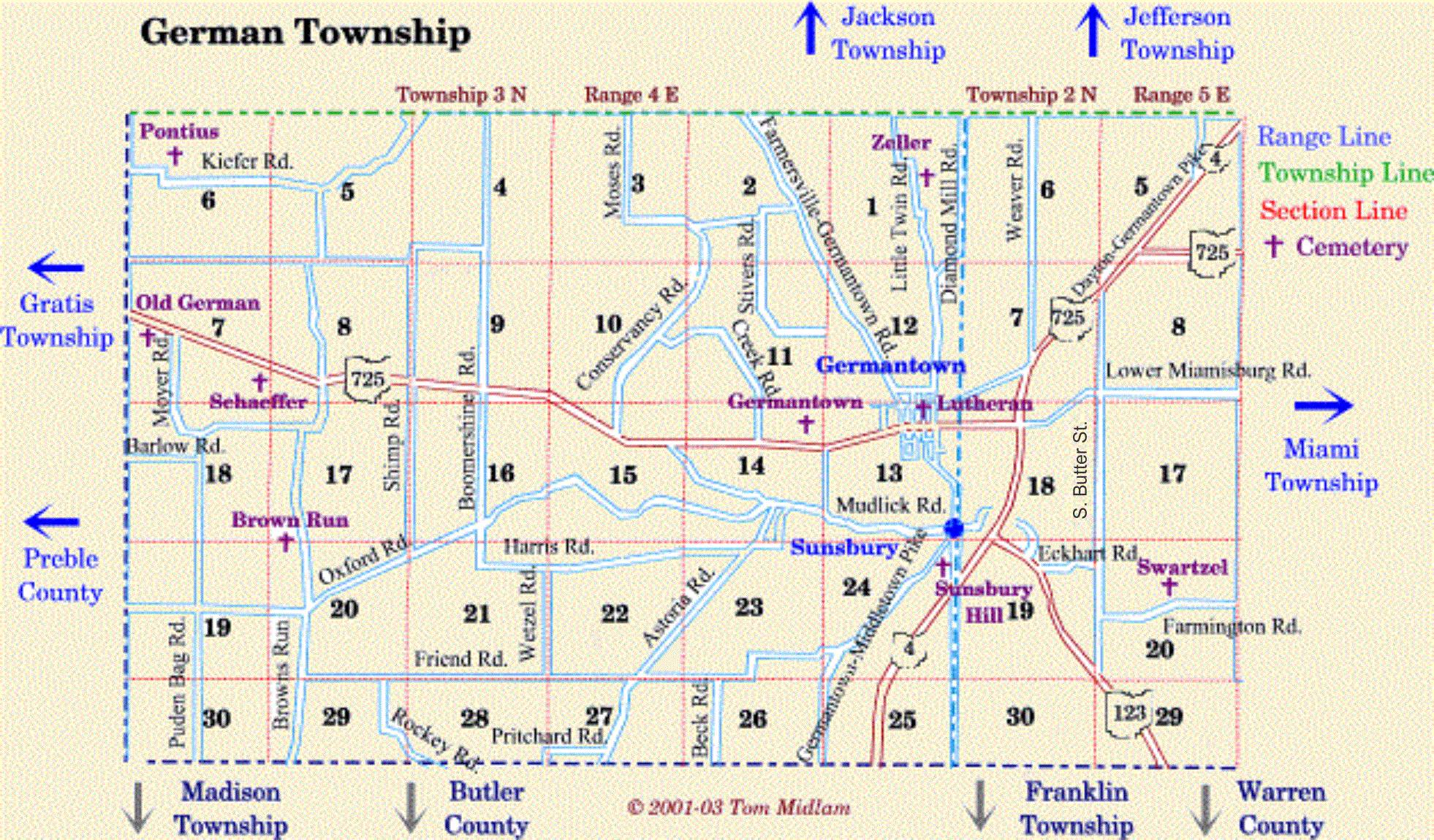
Cemeteries in German Township |
|
| Name |
Other Name |
Location |
Section |
Latitude / Longitude |
| Brown Run |
Judy |
West of Brown Run Rd. and north of Oxford Rd. |
17, SW1/4
T3N, R4E
|
|
| Dutch |
German (old) |
South side of SR 725 just east of the Preble County Line Rd. |
7, NW1/4
T3N, R4E
|
|
| Germantown |
|
North of SR 725 at west edge of Germantown |
14, NE1/4
T3N, R4E
|
|
| Lutheran (old) |
|
Northeast corner of Plum & Warren St., in Germantown |
13, NE1/4
T3N, R4E
|
|
| Pontius |
|
North of Baden Rd. and east of Preble County Line Rd. |
6, NW1/4
T3N, R4E
|
|
| Schaeffer |
State Road Church |
South of SR 725 and west of Brown's Run Rd. |
7, SE1/4
T3N, R4E
|
|
| Sunsbury |
Sunsbury Hill |
West of Eby Rd. and south of Germantown Pike |
24, NE1/4
T3N, R4E
|
|
| Swartzel |
|
North side of Farmington Rd. and west of Jamaica Rd. |
20, NE1/4
T2N, R5E
|
|
| Zeller |
|
East of Little Twin Rd. and north of Diamond Mill Rd. intersection (abandone) Graves moved to Germantown Cemetery. |
1, NE1/4
T3N, R4E
|
moved |
|